Right, it’s time to get those snow dancing shoes out again and get dancing! We’ve enjoyed a mainly sunny week with clear blue skies and very cold nights. Thankfully the easterly winds have passed and we'll be experiencing higher temperatures in the coming days. We currently have a high pressure weather system in place over central Europe and the week ahead looks like it will continue dry, sunny and fairly cold.
In Courchevel the temperatures will be on the rise, reaching a maximum of 5°C by Tuesday morning with a minimum of 0°C by Sunday afternoon. The freezing level will also increase to around 2850m in the next few days. Regrettably, there is no snow in sight at the moment. However, we are only looking a few days ahead, as there is limited accuracy after that. The snow is in good condition, but the sunshine and wind this week have created some quite hard crusty surfaces in places. The risk of avalanches is slowly reducing due to the combination of sunshine and high-pressure weather. Nevertheless, above the treeline, the risk remains high due to weak layers in old snow and wind slabs, which can be challenging to spot.
We caught up with the guys over at Whitestorm ski rental, who are out on on the pistes now and they tell us "the snow here is holding up well due to the cold overnight temperatures. We are just slightly above freezing during the day but the sun brings a nice source of warmth. Clear blue skies during the day and cold nights are expected to continue well into next week and beyond. Perfect for the Courchevel Méribel 2023 World Championships"
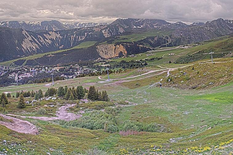
Great shot above from the pistes of Courchevel by Cheval Blanc
Check out the pistes and snow conditions this week in Courchevel on 3 Vallees Tarentaise video below


![[itemref] lounge](https://cdm0lfbn.cloudimg.io/v7/_images_base_/image_uploader/photos/original/2103-1-eden-20_1_21030001_1000__wwatermark1363125858_1363125858.jpg?ua=1766709535&p=listing_summary_middle)